
Accurate and reliable data service for offshore wind development
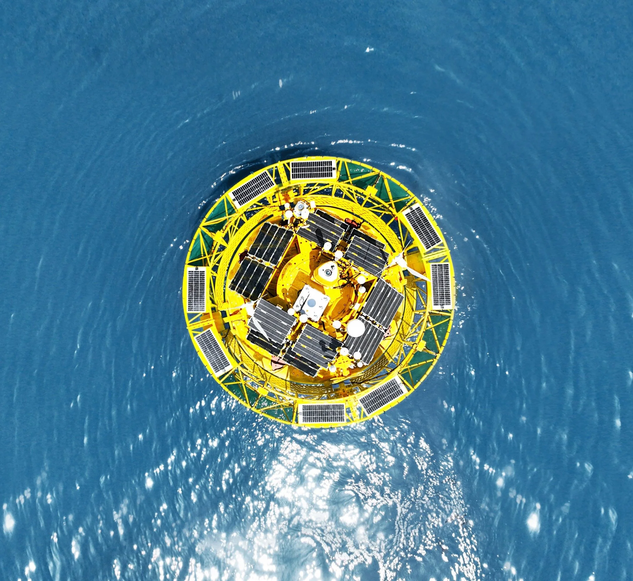
Next-generation offshore wind and metocean measurements: BA-FLS-NX5
Our floating LiDAR system is deployed offshore to collect wind and metocean data that supports the feasibility assessment of wind farms and critical decisions.
Now BA-FLS-NX5 is the world's first wind and metocean measurement system that has reached the Best Practice of OWA Stage 2 for 3 different LiDAR models. The verified LiDAR configurations include both WindCube V2 Offshore and ZX 300M, and dual Molas B300M LiDARs.
To provide complete solutions for the preliminary resource survey of wind farms
To provide critical decision data for wind farm design and investment evaluation to improve investment certainty
To provide data services for marine meteorological monitoring and forecasting
To provide data support for marine disaster forecast warning modeling
Security
Abidance by international HSE standards
Data is encrypted for transmission and securely stored in the customer's local server
Reliability
Dual LiDAR system with both continuous wave and pulse wave LiDARs
Full redundancy to eliminate single-point failures
Accuracy
High raw data quality from specific buoy design
State-of-the-art motion compensation algorithm
Multiple third-party reports with OWA Stage 2 Best Practice
Post-processing TI data with Best Practice
Resilience
High survival rate after collisions, and structure design with multiple cabinets to prevent sinking if any water ingress
Proven track records of extreme weather experiences (violent storms, high temperatures, freeze and snow, rainy season, etc)
Outstanding collision endurance design

The combination of dual AIS system and dual navigation light provides redundant protection and reliable navigation information for the system, helping the vessels make better navigation decisions and reduce navigation accidents.
Dual AIS, dual navigation light

Double reinforcement protection rings can effectively withstand external impact, protect important components of the system, and avoid functional failure or damage caused by external impact.
Double reinforcement protection rings
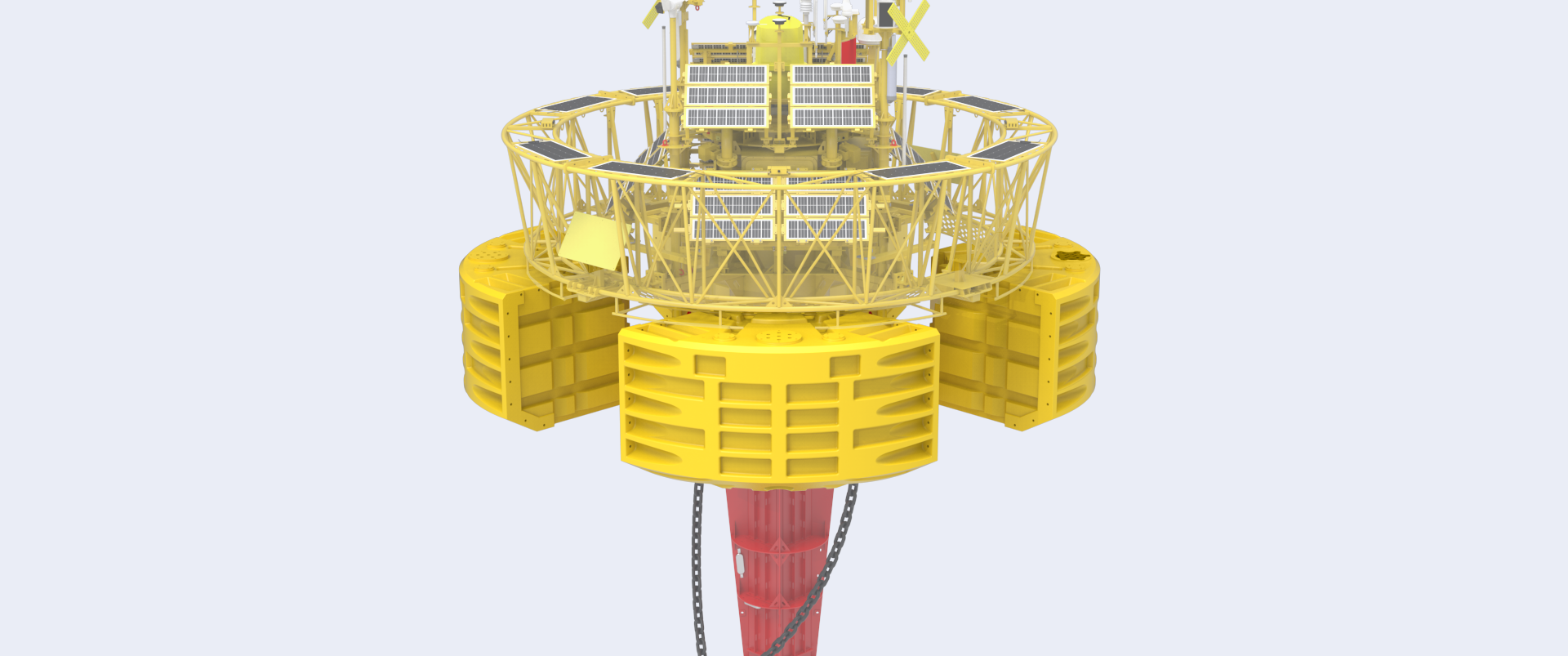
The system is designed with multiple cabinets, which have sufficient residual buoyancy even when all hulls are full of water to prevent the system from sinking under extreme circumstances.
Multiple solid cabinets
Sufficient power supply for one-year offshore measurement free of maintenance
Multiple groups of solar panels (total generating power 2464W) can optimize the collection and utilization of solar energy to ensure continuous and stable power supply.
Solar panels

Dual redundant wind turbines(total generating power 2 * 350W) fully use offshore wind to provide continuous power to the system.
Wind turbines

Dual redundant fuel cells can be used as a backup power source to provide stable power in extreme environmental conditions, enhancing the global environmental adaptability of the system.
Fuel cell (optional)
Site-specific mooring options
Typically, the system will adopt a combination anchor type of a 12-ton cement block and a 1.5-ton large holding power anchor. The anchor chain and the system will be double-point connected by saddle chain. This design has been verified by lots of typhoons.
According to the characteristics of the project site, considering the marine environment, geological conditions, and other factors, the multi-anchor mooring system can be customized.
With the position monitoring function, the system automatically triggers a warning when the offset position exceeds the safe range.
Single line double anchors mooring (<80m)

Double line double anchors mooring (<80m)

Single line double anchors mooring with floator(>80m)

Double line double anchors mooring with floator(>80m)

Product Specifications
-
Diameter: 5m
Height: 9m
Mass: 15t
Net buoyancy: 10t
Structure: multiple cabinets
-
Dual LiDAR(by default)
ZX 300M, Windcube V2 Offshore, Molas B300M
-
Temperature, humidity, and atmospheric pressure
Rainfall, solar radiation
Wind speed and direction
-
Wave (significant wave height, one-tenth wave height, maximum wave height, wave period, mean wave period, zero-crossing wave period, wave direction)
Current speed, current direction
Water depth/water temperature/salinity
-
Bird and bat monitoring
Sea mammal and fish monitoring
Water environmental monitoring
-
LAN
Satellites: SBD SAT messaging module, other Broadband SAT data modules (optional)
Mobile networks: 2G/3G/4G
WiFi: 2.4GHz/5GHz*2
Local ethernet connection